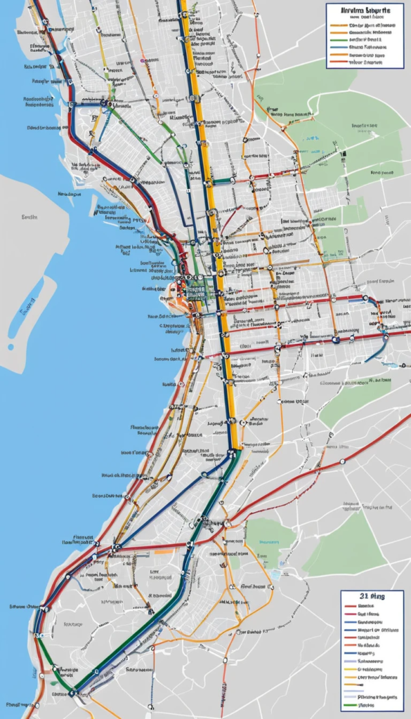
LIRR Map – The Long Island Rail Road (LIRR) is one of the busiest commuter rail networks in the United States, connecting New York City with Long Island. The system spans over 700 miles of track, serving 124 stations across 11 branches. Its extensive network ensures easy navigation for daily commuters and visitors traveling across Long Island and into Manhattan.
This is a staggering number of LIRR customers of all types relying on one of the largest and busiest commuter rail networks in the United States, which connects New York City with Long Island through a vast and extensive rail system. The system comprises 11 branches and 124 stations, spanning over 700 miles of track.
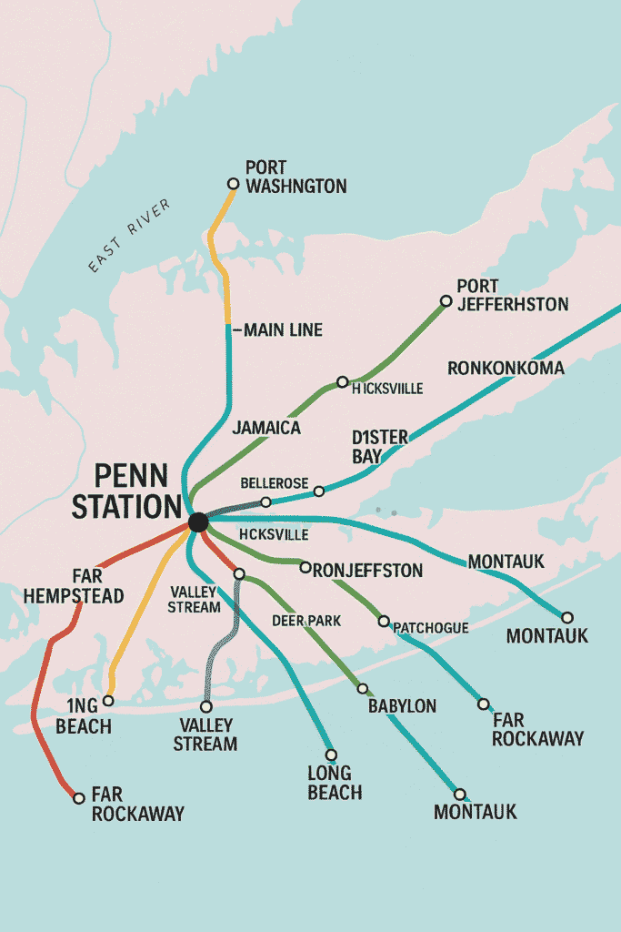
The LIRR interconnects Manhattan, Brooklyn, and Queens with the easternmost parts of Long Island, which provides basic transportation for commuters and travelers. Designed for rapid movement between different zones, the rail system connects major hubs such as Penn Station, Grand Central Madison, Atlantic Terminal, and Jamaica Station, which act as central transfer points for multiple subway and bus lines.
The LIRR operates 11 primary branches, each connecting different parts of Long Island with major transit hubs like Penn Station, Grand Central Madison, Atlantic Terminal, and Jamaica Station.
LIRR Stops Map
The Long Island Rail Road (LIRR) operates numerous stations across its network. Here’s a list of LIRR stations organized by their respective branches:
Each branch serves different zones and provides direct or connecting services to New York City.
LIRR Connectivity & Major Hubs
LIRR is strategically connected to other major transit systems, making it one of the most convenient commuter options in the region.
One of the LIRR’s biggest advantages is connectivity; it connects to New York City’s subway system, regional bus network, and ferry services. Transfer hubs at Jamaica Station, Atlantic Terminal, and Hicksville allow passengers to switch among various L.I.R.R. branches, subway lines, and local bus routes, facilitating travel throughout the metropolitan region. The recent opening of Grand Central Madison has greatly added to access to the East Side of Manhattan, relieving some congestion on Penn Station and giving commuters more flexibility in planning trips.
Major Transfer Stations & Connections
Station
Connections
Penn Station
NYC Subway (1, 2, 3, A, C, E), Amtrak, NJ Transit
Grand Central Madison
NYC Subway (4, 5, 6, 7, S)
Jamaica Station
AirTrain JFK, NYC Subway (E, J, Z)
Atlantic Terminal
NYC Subway (2, 3, 4, 5, B, D, N, Q, R)
Mineola
NICE Bus Service
Hicksville
NICE Bus Service, Ronkonkoma Branch
These stations serve as key transit points, allowing passengers to transfer seamlessly between trains, subways, and buses.
In using the LIRR, riders can also reference tools including interactive maps on the rail service’s website, the MTA TrainTime App that provides real-time tracking of train arrivals and departures, and schedule guides on the MTA website. The travel planning starts with some basics: what departure station and destination station are you looking to go between, what a schedule looks like in terms of peak and off-peak timing, and then purchasing the tickets via multiple convenient methods, such as the MTA eTix app, ticket machine, or station windows.
Once at the station, passengers can view the departure boards and track assignments before boarding their train. Riders who use our buses daily benefit from monthly and weekly passes, and those who use our buses less frequently can purchase single or 10-trip tickets.
How to Navigate the LIRR: A Step-by-Step Flowchart
Navigating the LIRR is simple with real-time schedules and ticketing options. The following flowchart outlines the steps to plan your journey effectively.
🔹 Start: Choose Your Departure & Destination Station
       ↓
🔹 Check LIRR Schedule (via Website or TrainTime App)
       ↓
🔹 Purchase Ticket (eTix App, Ticket Machine, or Station Window)
       ↓
🔹 Arrive Early & Check Track Assignments
       ↓
🔹 Board the Train & Validate Ticket
       ↓
🔹 Enjoy Your Ride & Monitor Announcements
       ↓
🔹 Arrive at Destination & Exit the Station
This structured, step-by-step process ensures a smooth travel experience across the LIRR network.
The LIRR has multiple branches that run to different areas of Long Island and serve commuters with local and long-distance trips. Those branches include the Babylon, Port Jefferson, Ronkonkoma, Montauk, and Hempstead lines, among others. Stations such as Jamaica, an important transfer point, enable riders to transfer across various branches and connect to AirTrain JFK, which serves travel to John F. Kennedy International Airport.
Penn Station and Grand Central Madison serve as the primary gateway to Manhattan, linking to the New York City Subway, Amtrak, and NJ Transit, uniquely integrating LIRR into the regional transit network.
LIRR Ticket Pricing & Fare Zones
LIRR ticket prices are determined by zones, with fares varying based on the distance traveled.
Ticket Type
Zone 1-3
Zone 4-7
Zone 8-10
Zone 11-14
🎫 Peak One-Way
$9.25
$13.00
$17.50
$24.50
🌅 Off-Peak One-Way
$6.75
$9.25
$12.25
$17.00
🔟 10-Trip Peak
$92.50
$130.00
$175.00
$245.00
📅 Monthly Pass
$165.00
$253.00
$341.00
$468.00
For the most cost-effective options, riders can use CityTicket for intra-city travel and weekly/monthly passes for frequent trips.
Fares on the LIRR are organized by travel zones, and ticket prices are based on distance. Zones are numbered from 1 to 14; zones with lower numbers represent destinations that are closer to Manhattan, while higher-numbered zones encompass more distant places (Greenport and Montauk). Ticket prices were divided into peak and off-peak fares, so riders could save if they traveled outside of rush hours. CityTicket options also offer discounted fares for travel within the NYC limits, so you can find lower prices on intra-city endeavors.
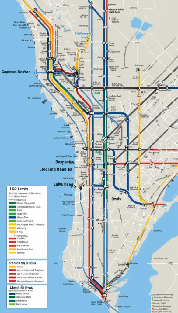
Future LIRR Map – Expansion Plans for LIRR
LIRR continues to expand to improve connectivity in the commuter experience. Recent and upcoming projects include:
Grand Central Madison: A new East Side Access terminal to reduce congestion at Penn Station.
Third Track Expansion: Adding a third track between Floral Park and Hicksville to increase service frequency.
Electrification Projects: Expanding electric train service to additional branches.
Modernization Efforts: Upgrading stations, ticketing systems, and train fleets for a better passenger experience.
The LIRR rail network is a vital part of New York’s public transportation system, providing efficient connectivity across New York City and Long Island. With its diverse routes, frequent schedules, and integration with subway and bus services, LIRR remains the most convenient travel option for commuters. Whether you’re traveling for work, leisure, or weekend getaways, the LIRR ensures seamless, reliable, and comfortable transit experiences.
Long Island Rail Road (LIRR) “The Future – Electrification, service reliability, station infrastructure and expansion.” The Third Track Project, which creates an additional track between Floral Park and Hicksville, is intended to increase train frequency and decrease delays. Efforts to modernize include improvements in digital ticketing, upgraded railcars, and expanded service schedules, ensuring a more efficient commuting experience. The MTA is also striving to provide ADA accessibility at stations to make travel easier for all passengers.
The LIRR rail map is an essential tool for those traversing New York’s trains, clearly showing you where your route takes you, where transfers are, and where you’re going. Being one of the oldest and largest commuter rail networks in the country, LIRR is fairly significant even when it comes to transportation evolution; facilitating over 300,000 daily trips, the railways continue to adapt to the growing number of commuters over time, ushering in seamless transport across multiple points in Long Island and further. Whether you travel for work, leisure, or weekend getaways, LIRR is a fast, reliable, and convenient option for navigating the greater New York region.
The LIRR outline includes all Long Island Rail Road lines, stations, and associations, making it easier for riders to plan trips over NYC and Long Island.
2. Where can I find a printable version of the LIRR map?
You’ll download a printable LIRR outline from the official MTA site or pick one up at major LIRR stations.
3. Does the LIRR map include all fare zones?
Yes, the LIRR outline incorporates admission zones, which decide ticket pricing based on your flight and destination stations.
4. Are transfers between LIRR lines shown on the map?
Yes, key exchange focuses between LIRR branches and associations to tram and transport lines are checked on the outline.
5. How often is the LIRR map updated?
The MTA occasionally overhauls the LIRR outline to reflect benefit changes, unused stations, and plan alterations.
6. Is there an interactive or mobile version of the LIRR map?
Yes, the LIRR TrainTime app and MTA website offer an interactive map that allows zooming, searching stations, and planning routes.
7. Is a map of the LIRR available in a printable PDF file?
Yes, the most current LIRR map is available to download in PDF on the MTA site (use it offline).